
Not over the Gulf. Clearwater Beach faces west, so the sun comes up behind the hotels, between 6:34 a.m. (around June 10) and 7:42 a.m. (October 31 and March 14). For the sun rising over water, drive 3 miles to Bay Park on Sand Key, 11 miles to the Dunedin Causeway (open from 5 a.m., best March to September), or in winter about 9.5 miles to the Courtney Campbell Causeway. Honeymoon Island opens at 8 a.m., after every sunrise.
Key takeaways
- The sunrise point swings about 54 degrees over the year, from 63 degrees (east-northeast) in June to 116 degrees (east-southeast) in December. A shore that works in July can face land in January.
- Closest real sunrise view: Bay Park on Sand Key, 1551 Gulf Blvd, open sunrise to sunset with free parking. You get the sun, not the glow before it.
- Earliest gates: the Dunedin Causeway, open 5 a.m. to 11 p.m. Its north shore lines up over open water from March through September.
- December is the hard month. Only the south side of the Courtney Campbell Causeway and Safety Harbor's waterfront line up over a mile or more of water. The causeway's city recreation area opens at 6 a.m.; Safety Harbor's park is a construction zone until about the end of 2026.
Can you see the sunrise from Clearwater Beach?
You'll see the sky change, but not the sun on the water. Clearwater Beach is a narrow barrier island with the Gulf on its west side and Clearwater Harbor on its east. At dawn the sun comes up behind the hotels, and by the time it clears them it's well up. A clear morning turns the Gulf pale pink and blue, which is pretty, but it isn't a sunrise view.
For the sun rising over water, you need a shore that faces east: the harbor side of Sand Key, St. Joseph Sound at Dunedin, or Old Tampa Bay on the far side of Clearwater. Which one works depends on the month. If you'd rather stay on the sand for the evening show, see our Clearwater Beach sunset times guide.
Which spots line up with the sunrise over water, and are they open?
For each place we measured how much water lies between you and the first shoreline in the direction the sun comes up. "Open water" means at least a mile of water along most of that season's sunrise directions. Hours are from official pages, as of October 2026.
| Spot | Nov to Jan (sun at 106 to 116 degrees) | Feb to Apr, Sep to Oct (73 to 109 degrees) | May to Aug (63 to 80 degrees) | Open at sunrise? |
|---|---|---|---|---|
| Clearwater Beach, Gulf side (Pier 60 and the whole beach) | Faces west; sun rises behind the island | Same | Same | Not a sunrise view |
| Clearwater Beach Recreation Center slips, 69 Bay Esplanade | About 0.3 mi of water, then Island Estates | About 0.3 mi, then Island Estates | About 0.3 mi, then Island Estates | No. Slips open 8 a.m. to 10 p.m. |
| Memorial Causeway Bridge, main span | About 0.1 mi of water, then downtown Clearwater | Same | Same | Public sidewalk; no hours posted. No stopping cars on the bridge |
| Coachman Park, 300 Cleveland St | Faces west across the harbor | Same | Same | Yes, 5 a.m. to midnight, but faces the wrong way |
| Seminole Street Boat Ramp, 201 Seminole St | Faces west across the harbor | Same | Same | Launch open 24 hours, but faces the wrong way |
| Bay Park on Sand Key, 1551 Gulf Blvd (3.1 road miles) | Open water, about 1.3 mi, except about Dec 9 to Jan 3, when land edges into the view | Open water, about 1.3 mi (less in April and September) | Open water, 1.5 to 1.9 mi | Opens at sunrise; you miss first light |
| Dunedin Causeway, north shore, 61 Causeway Blvd (about 11 road miles) | Mostly under a mile; the view runs toward the causeway's eastern end | Open water in March, April and September, about 1.4 to 1.6 mi | Open water, about 1.4 mi | Yes, 5 a.m. to 11 p.m. |
| Honeymoon Island State Park, 1 Causeway Blvd | Not tested: the park is closed at every sunrise | No. 8 a.m. to sunset | ||
| Bayshore Trail, N Bayshore Blvd, Clearwater (about 10 road miles) | Land within a quarter mile at our test point | Open water in Sep, Oct, Mar and Apr, 3 to 6 mi of Old Tampa Bay | Open water, about 4 to 5 mi | No hours posted on the city's trail page |
| Courtney Campbell Causeway, Clearwater end, 3401 Gulf to Bay Blvd (about 9.5 road miles) | Open water from the south side, about 10 mi | Open water from the south side Sep to Mar; north side in April | Open water from the north side, about 5 mi | Yes. City recreation area 6 a.m. to 9 p.m., $15 parking. Trail closure notice (see below) |
| Safety Harbor Waterfront Park (about 11 road miles) | Open water, 3.4 mi or more | Open water, 3 mi or more | Open water, 1.4 to 4.5 mi | Under construction through about December 2026; hours not posted |
| Philippe Park, 2525 Philippe Pkwy, Safety Harbor (about 13 road miles) | About 0.9 mi across Old Tampa Bay | About 0.8 mi | About 0.8 mi | 7 a.m. to sunset: closed at sunrise Nov 1 to 23, Feb 26 to Mar 13 and Apr 23 to Aug 11 |
Road distances from Pier 60 are routing estimates. Our pick: Bay Park for convenience, the Dunedin Causeway from March to September if you want first light too, and the Courtney Campbell Causeway in winter, where the south side looks across about 10 miles of open bay and the city's recreation area opens at 6 a.m.
We computed sunrise, first light (start of civil twilight) and the sun's bearing at sunrise for every day from October 1, 2026 to September 30, 2027 at 27.978° N, 82.828° W, using the equations behind the NOAA Solar Calculator. Against the U.S. Naval Observatory API, 60 of 62 times on 31 test dates matched to the minute (two June sunrises were a minute apart), and bearings on 16 dates matched within 0.1 degree. Times shown are USNO's. For the water, we downloaded the OpenStreetMap coastline through the Overpass API on October 4, 2026, set one test point at the water's edge of each place (Bay Park 27.9411, -82.8353; Dunedin Causeway 28.0557, -82.8053; Bayshore 27.9764, -82.6953; Courtney Campbell 27.9631, -82.6871 north and 27.9619, -82.6873 south; Safety Harbor 27.9908, -82.6845; Philippe 28.0078, -82.6771; Recreation Center 27.9840, -82.8239; bridge 27.9659, -82.8061; Coachman Park 27.9663, -82.8044; Seminole Street ramp 27.9740, -82.8026), and measured the distance to the first shoreline along every whole-degree bearing from 55 to 125. It ignores buildings, trees and bridge decks, and results change if you stand elsewhere on the shore. Opening hours come from the official pages listed under Sources, checked October 4 and 5, 2026.
When is first light and sunrise each month, and where does the sun come up?
One row per month, for the 15th. First light (civil twilight) comes 23 to 27 minutes before sunrise. The last column lists tested spots with at least a mile of water toward the sun that month.
| Date | First light | Sunrise | Sun comes up at | Lines up over water |
|---|---|---|---|---|
| Oct 15, 2026 | 7:08 a.m. | 7:32 a.m. EDT | 99° (east, 9° south) | Bay Park, Bayshore Trail, Courtney Campbell south side, Safety Harbor |
| Nov 15, 2026 | 6:28 a.m. | 6:53 a.m. EST | 111° (east-southeast) | Bay Park, Courtney Campbell south side, Safety Harbor |
| Dec 15, 2026 | 6:49 a.m. | 7:15 a.m. EST | 116° (east-southeast) | Courtney Campbell south side, Safety Harbor |
| Jan 15, 2027 | 6:59 a.m. | 7:24 a.m. EST | 114° (east-southeast) | Bay Park, Courtney Campbell south side, Safety Harbor |
| Feb 15, 2027 | 6:45 a.m. | 7:09 a.m. EST | 104° (east-southeast) | Bay Park, Courtney Campbell south side, Safety Harbor |
| Mar 15, 2027 | 7:18 a.m. | 7:41 a.m. EDT | 92° (almost due east) | Bay Park, Dunedin Causeway, Bayshore Trail, Courtney Campbell south side, Safety Harbor |
| Apr 15, 2027 | 6:43 a.m. | 7:07 a.m. EDT | 78° (east-northeast) | Dunedin Causeway, Bayshore Trail, Courtney Campbell north side, Safety Harbor |
| May 15, 2027 | 6:16 a.m. | 6:42 a.m. EDT | 68° (east-northeast) | Bay Park, Dunedin Causeway, Bayshore Trail, Courtney Campbell north side, Safety Harbor |
| Jun 15, 2027 | 6:08 a.m. | 6:35 a.m. EDT | 63° (east-northeast) | Same as May |
| Jul 15, 2027 | 6:19 a.m. | 6:45 a.m. EDT | 65° (east-northeast) | Same as May |
| Aug 15, 2027 | 6:37 a.m. | 7:01 a.m. EDT | 74° (east-northeast) | Same as May |
| Sep 15, 2027 | 6:53 a.m. | 7:16 a.m. EDT | 86° (almost due east) | Dunedin Causeway, Bayshore Trail, Courtney Campbell south side, Safety Harbor |
Bearings are degrees from true north (90 is due east). The latest sunrises, 7:42 a.m., come on October 31, 2026, the day before clocks fall back, and on March 14, 2027, the day they spring forward. The earliest is 6:34 a.m., around June 10.
Honeymoon Island State Park posts hours of 8 a.m. to sunset, 365 days a year, and sunrise is never later than 7:42 a.m., so you can't be inside for any sunrise. Philippe Park's 7 a.m. opening misses sunrise on 150 days of our 12-month window: November 1 to 23, February 26 to March 13 and April 23 to August 11. Pinellas County also closes its parks the day after Thanksgiving and on December 25. Bay Park opens at sunrise itself.
Why is Clearwater a sunset beach and not a sunrise beach?
The Gulf lies to the west, so the sun sets over open water every evening and rises over the island, the harbor and the mainland every morning. It only rises due east around the equinoxes. At about 28 degrees north it comes up about 27 degrees north of east at the June solstice and 26 degrees south of east in December, which is why no single shore works all year.
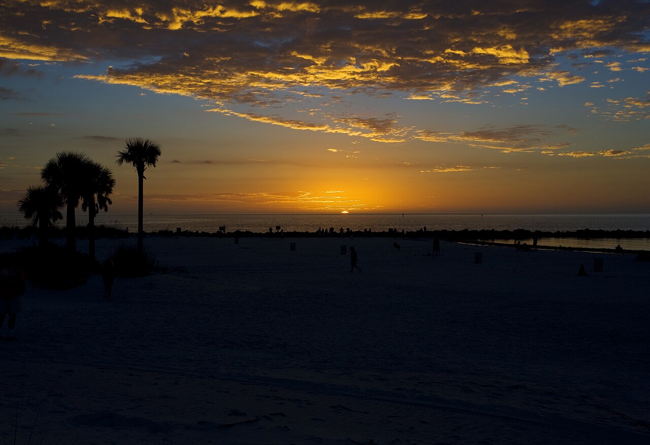
Official sunrise assumes a flat, open horizon. Across a bay the far shore is a low line of trees and buildings, so the sun may show a few minutes after the posted time. Arrive at first light; the sky often colors before the sun appears. Calm mornings by the water can also bring biting midges, so check our guide to no-see-ums and mosquitoes at Clearwater Beach before you go.
What should you know about each sunrise spot?
Bay Park on Sand Key
This small city park sits on the harbor side of Sand Key at 1551 Gulf Blvd, about 3 road miles south of Pier 60. The City of Clearwater lists free parking, a small beach access area, a toddler playground and tennis and pickleball courts, with hours of sunrise to sunset. It looks east across 1.3 to 1.9 miles of Clearwater Harbor, depending on the month. Pets aren't allowed on public bathing beaches under the city rules posted on the same page (service animals excepted). For places that do welcome pets, see where dogs are allowed around Clearwater Beach.
Dunedin Causeway
The City of Dunedin says the causeway at 61 Causeway Blvd is open for recreation from 5 a.m. to 11 p.m., with free parking along the access areas beside the road. Stand on the north shore: from March through September the sun rises over about 1.3 to 1.6 miles of St. Joseph Sound. From October through February the sunrise moves toward the causeway's own eastern end and the view shortens to under a mile in places. Alcohol, camping, ground fires and dogs on the beach aren't allowed. The road continues to Honeymoon Island State Park, a good morning stop after 8 a.m. ($8 per vehicle as of October 2026). For a meal on the way back, see our picks for the best restaurants in Dunedin.
Bayshore Trail and the Courtney Campbell Causeway
On Clearwater's Old Tampa Bay side, the city's Bayshore Trail runs beside Bayshore Boulevard and links to the Courtney Campbell Trail, which crosses the bay toward Tampa. These have the longest water views on the page: 4 to 6 miles from Bayshore between spring and early fall, and about 10 miles from the causeway's south side in winter.
The Courtney Campbell Beach Recreation Area, 3401 Gulf to Bay Blvd, sits at the Clearwater end of the causeway beside the trail. Its posted hours, 6 a.m. to 9 p.m. seven days a week, cover first light all year. Parking on the Clearwater side is a flat $15 per vehicle per day (as of October 2026). The Bayshore Trail page posts no hours. In October 2026 the Courtney Campbell Trail page carried a notice that the trail is "closed for maintenance" from the recreational beach entrance until further notice, dated only "Oct. 21" with no year. Check it before you drive over in the dark.
Safety Harbor Waterfront Park and Philippe Park
Safety Harbor's waterfront faces 1.4 to 9 miles of Old Tampa Bay and lines up every month. The catch is access. The city's notice (last updated September 14, 2026) says the park, pier, marina and part of the boardwalk took significant damage in the 2024 hurricane season and the pier was swept away. Repairs began July 7, 2025 and are expected to finish by the end of December 2026. Until then the boat ramp, marina and Veterans Memorial Lane parking are closed, and you reach the park from the north entry near Jefferson Street. The same notice says 32 of the 35 bollard lights along the trail don't work, so bring a light before dawn. We found no posted hours. Pinellas County's Philippe Park, 2525 Philippe Pkwy, opens at 7 a.m. and looks across a narrower 0.8 to 0.9 miles of bay.
Close to the beach, but facing the wrong way
Coachman Park (5 a.m. to midnight) and the Seminole Street Boat Ramp (launch open 24 hours) are on the downtown side of the harbor and face west. The Recreation Center slips at 69 Bay Esplanade face east, but across only about 0.3 miles of water to Island Estates, and open at 8 a.m.
Can you watch the sunrise from the Memorial Causeway Bridge?
You can walk up, but the first shoreline to the east is downtown Clearwater, about a tenth of a mile away, in every season. The sun rises behind the skyline. What you get is height and a wide look back at the harbor and beach towers as the light comes up.
Florida Statutes section 316.1945 bars stopping, standing or parking a vehicle on a bridge or elevated structure on a highway, except to avoid traffic or when directed by police or traffic signals, so don't pull over on the causeway. Section 316.130 says pedestrians shouldn't walk in the roadway where sidewalks are provided. Park off the bridge, walk up on the sidewalk, and wear something light-colored or reflective in the dark.
What can you do after sunrise?
Once the sun is up, the rest of the morning is yours. Our best time of day guide covers how crowds and heat change through the day.
- Shelling: find a daylight low in our Clearwater Beach tide guide, then see the shelling guide for where to look.
- A run: the Memorial Causeway sidewalk and the Beach Walk make easy out-and-back routes. See the running guide.
- A morning boat: compare departures in the dolphin tour guide and confirm the first sailing for your date.
- Launch mornings: by our rough calculation the Cape Canaveral pads lie about 72 to 73 degrees from Pier 60, near the sunrise direction from late April into early May and in mid-August. The rocket launch guide covers what you can see.
Sunrise and first-light times come from the U.S. Naval Observatory. Bearings and water distances are our own calculations from NOAA's solar equations and OpenStreetMap coastline data. Hours, rules and construction status come from city, county and state park websites, checked October 2026. We didn't visit these spots for this article. We're an independent guide, and nobody named here pays us.
Frequently asked questions
Is Clearwater Beach better for sunrise or sunset?
Sunset, clearly. The beach faces west over open Gulf, so the sun sets over water every night of the year. At sunrise it comes up behind the island.
What time is sunrise at Clearwater Beach?
Between 6:34 a.m. (around June 10) and 7:42 a.m. (October 31 and March 14) in the year from October 2026. First light comes 23 to 27 minutes earlier.
Where is the closest place to watch the sunrise over water?
Bay Park on Sand Key, 1551 Gulf Blvd, about 3 road miles from Pier 60. It faces 1.3 to 1.9 miles of harbor toward the sunrise in most months, but opens only at sunrise.
Can you watch the sunrise at Honeymoon Island?
Not inside the park, which opens at 8 a.m. The Dunedin Causeway leading to it opens at 5 a.m., and its north shore lines up from March through September.
Can I see the sunrise from my hotel?
Only from an east-facing (bay-side) room, and on the main island those look across the harbor toward Island Estates or the mainland. Ask for a high-floor bay view if it matters, and see our neighborhood guide to where to stay to compare areas.
Where should I go for a sunrise in December?
The south side of the Courtney Campbell Causeway, which looks across about 10 miles of open bay; the city's recreation area there opens at 6 a.m. Safety Harbor's waterfront also lines up, but it's a construction zone until about the end of 2026. Philippe Park opens before every December sunrise (it's closed December 25) but faces under a mile of water.
Sources
- U.S. Naval Observatory, Astronomical Applications API (sun rise, set and twilight times; sun azimuth from the celestial navigation service), queried October 2026 for 27.978° N, 82.828° W. aa.usno.navy.mil
- U.S. Naval Observatory, Rise, Set, and Twilight Definitions. aa.usno.navy.mil
- NOAA Global Monitoring Laboratory, Solar Calculator and solar-position equations. gml.noaa.gov
- OpenStreetMap contributors, coastline data (natural=coastline) via the Overpass API, retrieved October 4, 2026; data available under the Open Database License. openstreetmap.org
- NIST, Daylight Saving Time rules. nist.gov
- City of Clearwater, Bay Park on Sand Key. myclearwater.com
- City of Clearwater, Clearwater Beach Recreation Center Boat Slips. myclearwater.com
- City of Clearwater, Coachman Park. myclearwater.com
- City of Clearwater, Seminole Street Boat Launch. myclearwater.com
- City of Clearwater, Bayshore Trail and Courtney Campbell Trail pages (including the maintenance closure notice). Bayshore Trail and Courtney Campbell Trail
- City of Clearwater, Courtney Campbell Beach Recreation Area (hours, parking fee, address). myclearwater.com
- City of Dunedin, Dunedin Causeway. dunedin.gov
- Florida State Parks, Honeymoon Island State Park (hours, fee, address). floridastateparks.org
- City of Safety Harbor, Pier & Marina Projects news notice (Waterfront Park, pier, marina and boardwalk; last updated September 14, 2026). cityofsafetyharbor.com
- Pinellas County, Philippe Park (hours and holiday closures). pinellas.gov
- Florida Statutes, section 316.1945 (stopping, standing or parking prohibited in specified places). leg.state.fl.us
- Florida Statutes, section 316.130 (pedestrians; traffic regulations). leg.state.fl.us
- Road distances: OpenStreetMap-based routing (OSRM), October 2026. Estimates only.
Make an early start of it
Breakfast spots, a beach yoga class, or a walk while the sand is still empty.
Plan your visit