
Launch at the city's Seminole Street Boat Launch (201 Seminole St., eight lanes, open 24 hours, $20 a day for a truck and trailer) or Pinellas County's Belleair Causeway ramp ($6 a day, rising to $12 on December 1, 2026). For lunch by boat, use the public slips behind Island Way Grill (20 Island Way). As of October 2026, the Clearwater Beach Marina has no day docks and no working fuel dock.
Key takeaways
- Seminole Street is the closest multi-lane public ramp: about 10 minutes' drive from Pier 60 and roughly 2 nautical miles by water to Clearwater Pass. The city publishes no launch fee, only trailer parking at $20 a day.
- Pinellas County's three standalone ramps (Belleair Causeway, Park Boulevard and Sutherland Bayou) charge $6 a day through November 30, 2026, then $12 a day (plus tax) from December 1.
- The city lists three day tie-ups: the Island Estates public slips, the Clearwater Beach Recreation Center slips (8 a.m. to 10 p.m.) and the free G dock at Clearwater Harbor Marina downtown (4-hour limit).
- The Dunedin Marina, ramp and day docks included, is still closed after damage from Hurricanes Helene and Milton.
- Every fixed bridge on the main routes clears 74 feet or more. The exception is a 14-foot fixed bridge over Mandalay Channel at the west end of the Memorial Causeway.
- The water between the Memorial Causeway and the Seminole Street ramp is a year-round manatee slow-speed zone, ICW channel included.
Where can you launch a trailer boat near Clearwater Beach?
Four public trailer ramps with posted parking rates on the Gulf side of Pinellas County are open and within about half an hour's drive of Pier 60. Only two, Seminole Street and Belleair Causeway, are within about 4 nautical miles of Clearwater Pass. The Dunedin Marina ramp is closed, and the Dunedin Causeway launch beaches don't allow motors.
| Ramp | Lanes and trailer spaces | Hours | Parking fee (as of Oct 2026, plus tax where noted) | Drive from Pier 60 | By water to Clearwater Pass |
|---|---|---|---|---|---|
| Seminole Street Boat Launch, 201 Seminole St., Clearwater (city) | 8 lanes with floating docks; FWC's inventory counts 115 trailer spaces | 24 hours, every day | Truck and trailer $20 a day, 72-hour limit; cars $2.25 an hour. Pay-by-plate kiosk or ParkMobile. No annual pass | 3.7 mi, about 10 min | About 2 nm, under the Memorial Causeway bridge (74 ft) |
| Belleair Causeway Public Boat Ramp, 3900 W. Bay Dr., Belleair Bluffs (county) | 10 lanes; FWC counts 106 trailer spaces | 24 hours; restrooms closed 10 p.m. to 3 a.m. | $6 a day with or without a trailer; $12 a day (plus tax) from Dec. 1, 2026. Cashless pay-by-plate (Visa, Mastercard, American Express) | 6.0 mi, about 16 min | About 3.5 to 4 nm |
| Park Boulevard Public Boat Ramp, 18651 Gulf Blvd., Indian Shores (county) | 6 lanes; FWC counts 73 trailer spaces | 24 hours | $6 a day; $12 from Dec. 1, 2026 | 10.4 mi, about 27 min | About 8 to 9 nm, through the Park Boulevard and Indian Rocks drawbridges and under the Belleair Causeway bridge (75 ft) |
| Sutherland Bayou Public Boat Ramp, 2119 U.S. Alt. 19 N., Palm Harbor (county) | 1 lane; FWC counts 30 trailer spaces | 24 hours | $6 a day; $12 from Dec. 1, 2026 | 12.3 mi, about 26 min | About 10 nm, through the Dunedin Causeway drawbridge and under the Memorial Causeway bridge (74 ft) |
| Dunedin Marina ramp, 51 Main St., Dunedin (city) | 1 lane | Closed (hurricane damage) | Posted rate $10 a day; no reopening date | n/a | n/a |
| Dunedin Causeway launch beaches | Non-motorized boats only | Causeway open 5 a.m. to 11 p.m. | Overnight parking permit $10 (two days) or $100 a year | n/a | n/a |
If you launch in Pinellas often, the county's annual boat pass costs $140 plus tax from October 1, 2026 ($105 with the military discount, $70 for the senior pass, free for disabled U.S. veterans). At $12 a day after December 1, it pays for itself in about a dozen launches. Seminole Street has no annual pass, and the city enforces its lot from 6 a.m. to 6 p.m.
FWC's inventory also lists a one-lane "Clearwater Beach Public Boat Ramp" at the Clearwater Beach Recreation Center, 69 Bay Esplanade. The city's Marine and Aviation page lists a Clearwater Beach boat ramp among its facilities but publishes no details or trailer parking for it, and the city's Beach Recreation Center and Library lot (51 Bay Esplanade, 72 spaces) charges $3.50 an hour. Call Marine and Aviation (727-562-4955) before you tow there.
Bound for the beach, the pass or Caladesi: Seminole Street, the shortest run. Heading south, or not keen on $20 for the trailer: Belleair Causeway, $6 a day until December 1 and $12 after that. Park Boulevard only makes sense for a day in The Narrows or farther south. If you're trailering north for scallop season, note that nearly all of Pinellas is closed to bay scallops.
Where can you tie up for the day, or overnight?
The public day docks near the beach are run by the City of Clearwater. The details below come from the city's Marine and Aviation pages as of October 2026, plus Dunedin's marina page.
| Dock | Where | Hours and limits | Cost (as of Oct 2026) |
|---|---|---|---|
| Island Estates Public Boat Slips | 20 Island Way, behind Island Way Grill | Every day, first come, first served | No fee listed by the city |
| Clearwater Beach Recreation Center slips | 69 Bay Esplanade, bay side of the north beach | 8 a.m. to 10 p.m.; no overnight stays | No fee listed by the city |
| Clearwater Harbor Marina, G dock (day use) | 206 Pierce St., downtown Clearwater | 8 a.m. to 9 p.m.; 4-hour limit | Free |
| Clearwater Harbor Marina (transient) | Same marina; 126 slips (30 to 55 ft) plus overnight side-tie space for visitors | Overnight; reserve on Dockwa; harbormaster on VHF 16, 8 a.m. to 8 p.m. | $3.50 per foot per day; $17.50 per foot per week |
| Clearwater Beach Marina | 25 Causeway Blvd. | No transient or day docks during the renovation | n/a |
| Dunedin Marina day docks | 51 Main St., Dunedin | Closed by Fire Marshal order after hurricane damage (normally four free slips, 4-hour limit) | n/a |
At the posted rate, a transient night for a 24-foot boat at Clearwater Harbor Marina is $84 ($3.50 x 24). For slip availability, call 727-562-4955 and press 2.
City pages projected the renovation would finish in July or August 2026, but in early October 2026 the marina page still said there were "no transient or day docks available." Don't plan a lunch stop there by water until the city says the day docks are back. Our Clearwater Beach Marina guide covers the tours and charters that run from there.
Which restaurants can you reach by boat, and how far are they?
We went through the websites of waterfront restaurants from Dunedin to Indian Shores looking for slip counts, fees, length limits and time limits. Only three say anything clear about arriving by boat, and none posts a fee, length limit or time limit. Distances are approximate on-the-water routes from the Clearwater Pass Bridge, computed as described in the note below the table.
| Stop | What the restaurant or city publishes about boats | Slips, fee, length, time limit | From Clearwater Pass Bridge | Bridges on the way |
|---|---|---|---|---|
| Island Way Grill, 20 Island Way, Island Estates (727-461-6617) | Restaurant: "Our dock slips are available every day on a first come first serve basis." City public slips are behind the restaurant. | Number of slips, fee, length and time limit not published | About 1.5 nm | 14-ft fixed bridge over Mandalay Channel on the short route (see below) |
| Downtown Clearwater, via the Clearwater Harbor Marina G dock, 206 Pierce St. | City: free day mooring on G dock | Free, 4 hours, 8 a.m. to 9 p.m. | About 1.5 nm | None |
| North-beach restaurants, via the Recreation Center slips, 69 Bay Esplanade | City: public slips, no overnight | Fee not listed; 8 a.m. to 10 p.m. | About 1.5 nm | 14-ft fixed bridge on the short route |
| Crabby's Dockside (37 Causeway Blvd.) and Marina Cantina (25 Causeway Blvd.) | Neither site mentions boat docking. City: no day docks at the Clearwater Beach Marina during renovation | None available now | About 1 nm | None |
| Bon Appétit Restaurant, 148 Marina Plaza, Dunedin (727-733-2151) | Restaurant: arriving boaters "can use a day dock for free at the Dunedin Public Marina, adjacent to the restaurant" | Those day docks are closed (City of Dunedin, October 2026) | About 4.5 nm | Memorial Causeway (74 ft fixed) |
| Salt Rock Grill, 19325 Gulf Blvd., Indian Shores (727-593-7625) | Restaurant: "Visit by land or by sea." No dock rules posted | Not published; call ahead | About 8 to 9 nm | Belleair Causeway (75 ft fixed), Indian Rocks SR 688 drawbridge (21 ft closed) |
The verdict: Island Way Grill is the only restaurant with a published tie-up that's open now, and the city's public slips are right behind it. Salt Rock Grill invites you to come "by sea" but posts no dock rules, so call before the long run south. Our Island Estates guide covers what else is near the Island Way slips. Bringing fish to dinner? See which Clearwater Beach restaurants will cook your catch.
About the 14-foot bridge: the Coast Pilot puts it over Mandalay Channel at the west end of the Memorial Causeway, just north of the Clearwater Beach Marina turning basin. The 1.5 nm figures for Island Way Grill and the Recreation Center slips assume you go under it. Taller boats can use the daybeacon-marked channel the Coast Pilot describes from ICW Mile 136.4 northwest to Mandalay Channel, which by our estimate makes Island Way Grill about 2.5 nm from the Pass Bridge. Check the chart for depths.
Ramps: lanes, trailer spaces, coordinates and status come from FWC's Florida Boat Ramp Inventory (all 88 Pinellas records, last edited and downloaded October 4, 2026). Fees come from the operators, which sometimes differ from FWC's: the City of Clearwater's Seminole Boat Ramp Parking page and Pinellas County's boat ramp parking page (which also posts the December 1, 2026 increase). Drive times are OSRM routes on OpenStreetMap roads from Pier 60, without traffic. Docks: the City of Clearwater's Boating and Marinas pages and the City of Dunedin's marina page, read October 4 and 5, 2026. Restaurants: each restaurant's own pages, fetched October 5, 2026. Distances: a straight leg from the Clearwater Pass Bridge to the Intracoastal Waterway, along the ICW centerline in OpenStreetMap, then a straight leg to the dock (beach-side stops go through the marina turning basin). Addresses were placed with the U.S. Census Bureau geocoder, and results were checked against the ICW mileage in U.S. Coast Pilot 5. Where the two methods differed by more than half a nautical mile, we show a range. These are trip-planning numbers; use the chart on the water. Scripts and outputs are archived with our research notes.
Will your boat fit under the bridges?
Probably, unless you're in a sailboat or headed up Mandalay Channel. Clearances come from U.S. Coast Pilot 5 (chapters 5 and 12, dated September 27, 2026). The ICW bridge figures are at mean high water, so at low tide you'll have a little more room. If you'd rather sail without taking a mast through the bridges, our guide to sailboat rentals and lessons covers the Sand Key options.
| Bridge | Where | Type | Vertical clearance | Notes |
|---|---|---|---|---|
| Clearwater Pass Bridge (Gulf Blvd.) | Clearwater Pass, the Gulf entrance | Fixed | 74 ft | Tidal current averages about 1.2 knots in the pass |
| Clearwater Memorial Causeway Bridge | ICW Mile 135.9 | Fixed | 74 ft | 315 ft horizontal |
| Mandalay Channel bridge, west end of Memorial Causeway | North of the Clearwater Beach Marina turning basin | Fixed | 14 ft at center | On the short route to the Recreation Center and Island Estates slips |
| Belleair Causeway Bridge | ICW Mile 131.8 | Fixed | 75 ft | 100 ft horizontal |
| Indian Rocks (SR 688) Bridge | ICW Mile 128.2, The Narrows | Bascule (drawbridge) | 21 ft closed | Opens on signal under federal drawbridge rules |
| Park Boulevard (SR 694) Bridge | ICW Mile 126.0, The Narrows | Bascule | 20 ft closed | Bridgetender on VHF 9, call sign WHV-751 |
| Dunedin Causeway Bridge | ICW Mile 141.9, St. Joseph Sound | Bascule | 24 ft closed | Bridgetender on VHF 9, call sign WHV-750 |
We found no special schedule for these three drawbridges in the federal drawbridge rules (33 CFR 117.287, as of October 2026), so the general rules apply and they open on signal. ICW miles are the Coast Pilot's statute miles from the Caloosahatchee River.
Where do you have to slow down?
Starting at the Seminole Street ramp. FWC's Pinellas County manatee rule (F.A.C. 68C-22.016) sets a year-round slow-speed zone over the water north of the Memorial Causeway bridge and east of Island Estates, ICW channel included, up to a line running from the peninsula with the Seminole Street boat ramp across to Island Estates. A second piece runs east of the ICW channel from that line north to Stevenson Creek. The rule also covers part of The Narrows south of the Indian Rocks bridge, outside the marked channel.
FWC's boating restricted areas rule for Pinellas (F.A.C. 68D-24.010) adds slow-speed, minimum-wake zones at the bridges on this page:
- Memorial Causeway: from 1,215 feet southwest of the bridge to 920 feet northeast, and along the Clearwater shoreline east of the channel up to 3,315 feet north of the bridge.
- Belleair Causeway: 500 feet either side of the center span.
- Indian Rocks (SR 688): from 7,340 feet south of the bridge to 1,790 feet north, shoreline to shoreline.
- Park Boulevard (SR 694): from 6,270 feet southeast of the bridge to 3,050 feet north, shoreline to shoreline.
- Honeymoon Island Causeway: 500 feet either side of the bridge.
FWC defines slow speed, minimum wake as operating "fully off plane and completely settled in the water." Watch for posted signs, too. Our manatees near Clearwater Beach page covers where and when you're most likely to see them.
Where can you get fuel and a pump-out?
Not at the city's marina on the beach right now. In early October 2026, the city's Marine and Aviation page said "the fuel dock is not currently operating," and the Clearwater Beach Marina page said the new fuel dock isn't in service and a temporary one is being installed. The marina's posted rules put fuel dock hours at 6:30 a.m. to 6:30 p.m. daily when it's running. Call 727-562-4955 (option 2) for status.
The Coast Pilot lists fuel at unnamed private marinas along The Narrows (ICW Mile 128.8) and near Dunedin (Mile 141.8), but some of its marina notes date back decades, so call before counting on them. With a trailer boat, the easy fix is to fill up at a gas station before you launch. For pump-outs, the city says the ones at Clearwater Harbor Marina are operating.
How do you get from the ramp to Clearwater Pass, Caladesi or Three Rooker?
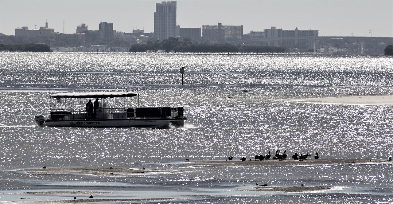
To the Gulf: from the Seminole Street ramp, idle south through the manatee zone, pass under the Memorial Causeway bridge (74 feet) and its slow-speed zone, and follow the ICW to the Clearwater Pass channel junction at Mile 135.5. Then turn west under the Clearwater Pass Bridge (74 feet). That's about 2 nautical miles. The Coast Pilot puts the tidal current in the pass at about 1.2 knots on average, so expect it to push you one way or the other. For dive sites on the artificial reefs past the Pass, our scuba guide lists each reef's distance and depth.
North to Caladesi: from Seminole Street, run north on the ICW into St. Joseph Sound. The Coast Pilot describes a privately dredged channel, reported at 4 feet deep in 2006, leading to a basin on the northeast side of Caladesi Island, west of ICW Mile 141.1 and inside Caladesi Island State Park. That's just short of the Dunedin Causeway drawbridge (Mile 141.9, 24 feet closed), which is about 4.5 to 5 nautical miles from the ramp. Check the park's rules and fees before you go. Our Caladesi Island guide covers the island itself.
Three Rooker Island: it's north of Honeymoon Island, and the shallows are the problem. The Coast Pilot says Hurricane Pass, between Caladesi and Honeymoon, "is subject to change," that the water west and north of Honeymoon Island was reported shoaled to bare in 1991, and that passage between Honeymoon Island and Three Rooker Bar "should only be made with caution." Go on a rising tide and check our Clearwater Beach tide guide first. Our Three Rooker Island guide covers nesting closures and landing.
FWC says anyone born on or after January 1, 1988 needs a boating education ID card and photo ID to run a boat with a motor of 10 hp or more. Our pontoon rental guide covers the rules and what local operators charge.
Facts come from City of Clearwater, Pinellas County and City of Dunedin pages (read October 4 and 5, 2026), U.S. Coast Pilot 5, FWC rules 68C-22.016 and 68D-24.010, the eCFR and each restaurant's own website. We didn't launch, dock, time or eat at any of these places ourselves, and the distances are computed, not measured on the water. We're an independent guide, and no ramp, marina or restaurant named here pays us.
Frequently asked questions
Where is the closest public boat ramp to Clearwater Beach?
For a trailer boat, the city's Seminole Street Boat Launch, 201 Seminole St.: eight lanes, open 24 hours, about 10 minutes' drive from Pier 60 and roughly 2 nautical miles by water from Clearwater Pass. FWC also lists a one-lane ramp at the Clearwater Beach Recreation Center (69 Bay Esplanade), but the city publishes no trailer parking there, so call 727-562-4955 first.
How much does it cost to launch at the Seminole Street ramp?
The city publishes parking fees, not a launch fee. As of October 2026, a truck and trailer pays $20 a day with a 72-hour limit, and cars pay $2.25 an hour. You pay at a pay-by-plate kiosk or in ParkMobile, and the city enforces it from 6 a.m. to 6 p.m.
Can you dock your boat at Clearwater Beach for lunch?
Yes, at city slips, but not at the Clearwater Beach Marina right now. Use the Island Estates slips behind Island Way Grill (first come, first served) or the Recreation Center slips at 69 Bay Esplanade (8 a.m. to 10 p.m.). Downtown, Clearwater Harbor Marina's G dock is free for 4 hours.
Can you get gas at the Clearwater Beach Marina?
Not as of early October 2026. The city says its fuel dock isn't operating and a temporary fuel dock is being installed during the marina renovation. Call 727-562-4955, option 2, for an update.
How much do Pinellas County boat ramps cost?
As of October 2026, the county's Belleair Causeway, Park Boulevard and Sutherland Bayou ramps charge $6 a day, with or without a trailer. From December 1, 2026, it's $12 a day plus tax. The annual boat pass is $140 plus tax.
How high is the Memorial Causeway bridge in Clearwater?
The main Memorial Causeway bridge over the ICW is a fixed span with 74 feet of vertical clearance at mean high water, per the Coast Pilot. The small fixed bridge over Mandalay Channel at the causeway's west end has only 14 feet at its center.
Sources
- City of Clearwater, Boating and Marinas (Seminole Street Boat Launch, Recreation Center slips, Island Estates slips, Clearwater Harbor Marina, Clearwater Beach Marina), accessed October 4-5, 2026. myclearwater.com
- City of Clearwater, Seminole Boat Ramp Parking (rates, limits, payment, enforcement hours). myclearwater.com
- City of Clearwater, Marine and Aviation Department (fuel dock status, renovation, facilities list, phone) and Marina Rules and Regulations (updated August 2025). myclearwater.com
- City of Clearwater, List of Beach Parking Lots and Garages (Beach Recreation Center and Library lot, 51 Bay Esplanade). myclearwater.com
- Pinellas County, Boat Ramp Parking (ramps, hours, $6 daily fee, $12 daily fee from December 1, 2026, annual pass rates from October 1, 2026). pinellas.gov
- City of Dunedin, Marina (closure, ramp and day dock status) and Dunedin Causeway (launch areas, hours, permits). dunedin.gov
- Florida Fish and Wildlife Conservation Commission, Florida Boat Ramp Inventory open data (Pinellas County), downloaded October 4, 2026. gis.myfwc.com
- NOAA Office of Coast Survey, U.S. Coast Pilot 5, chapter 12 (Gulf Intracoastal Waterway structures table and Clearwater Harbor to St. Joseph Sound), September 27, 2026. nauticalcharts.noaa.gov
- NOAA Office of Coast Survey, U.S. Coast Pilot 5, chapter 5 (Clearwater Pass, Dunedin Pass, Hurricane Pass, Anclote Keys), September 27, 2026. nauticalcharts.noaa.gov
- 33 CFR 117.287, Gulf Intracoastal Waterway drawbridge operations, Florida. ecfr.gov
- FWC, F.A.C. 68C-22.016, Pinellas County manatee protection zones (effective January 18, 2016). flrules.org
- FWC, F.A.C. 68D-24.010, Pinellas County boating restricted areas. flrules.org
- FWC, Boating Regulations (speed zone definitions, boating education ID requirement). myfwc.com
- Island Way Grill homepage (dock slips statement). islandwaygrill.com
- Bon Appétit Restaurant, About page ("Arrival by boat"). bonappetitrestaurant.com
- Salt Rock Grill homepage ("Visit by land or by sea," address and phone). saltrockgrill.com
- Distances: OpenStreetMap ICW centerline (way 162011046), U.S. Census Bureau geocoder, and OSRM road routing, October 2026. Estimates for trip planning only.
Leaving the trailer at home?
Rent a pontoon on the island and skip the ramp, the parking kiosk and the drive.
Compare pontoon rentals